
Coast Part 7 2010
I have almost tired of starting a blog by saying that the next stage of our trip around the UK coastline is decidedly different to the earlier ones. If you have read the previous blogs you will know that it is the mainland coast that we are travelling. This time it is East Anglia, starting at the Wash and finishing at the Thames. We have started or finished a leg before by staying with someone we have met on MotorHome Facts (MHF) but this is the first time that the first three nights have been spent on someone's driveway. It makes for a slow start but a convivial one.
The other difference on this trip was that we were starting out on the 1st of March which is a tad too early for the UK camping season, of that, more later. We cleared our diary to perhaps start this leg in the last week of February and then just looked for a dry weather window to get started. Sharing a van with two wet dogs is an acquired taste and one that you need to gently break yourself into. As in the previous parts I haven't mentioned here every little seaside village we passed through and so have produced a list as a seperate blog. This also includes the maps and links to the campsites, note the maps don't always show all the smaller roads
Day -1, 0 and 1 Getting to the Wash and beyond
We set off from Salisbury on a bright afternoon with the aim of getting to some friends at Hitchin by tea time, this was achieved despite the delays on the A1 at Hatfield (the tunnel is getting a major overhaul). Next morning we set off to the Lincolnshire boarders to stay with Jock and Rita and so it was on the third day that we left them to make a start on the coast proper at Sutton Bridge where we had finished last July. After leaving Sutton Bridge we went up the cut on the aptly named East Bank looking over the cut to where we had our final stop last July, on the equally imaginatively named West Bank road.
Soon we were heading for a place name with the word 'hill' in it! As suspected, Ongar Hill was as flat as its surroundings. We gently made our way to Kings Lynn. The plan was to meet up with Tina and Glenn at Kings Lynn for lunch but after a few texts and phone calls we went to their house instead and spent the night there. (We actually got a few miles past Kings Lynn, Huntstanton Beach and then went to Tina and Glenn's house via Sandringham, but didn't get an alternative offer of accomodation from HM).

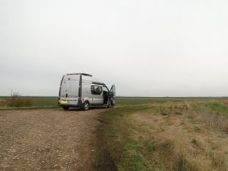
Our Start Point - On Ongar Hill!
  
 
Kings Lynn

Hunstanton Beach

1st day - 212 miles to start, 42 miles Coast
Day 2 Snettisham Scalp to Waybourne
So leaving Tina, Glenn, Buster and Skye we started on the coast again, the start being a bracing walk for the dogs on Heacham south beach. Cool but very sunny. We soon settled into our bimble mode and guided by our by now dog eared free guide to the seaside stopped for lunch at the White Horse, Brancaster Staithe. My first pint of Adnams this trip and an excellent poached haddock with egg on a bed of spinach and mashed potato. Dogs were allowed in but I wouldn't necessarily trust mine not to beg, in any case they were knackered after their morning walk. It continued to be brilliantly sunny but with a biting wind as we went into all the little byways and villages along this coast. 


Heacham Beach - Are these all Redshanks? - Morston
At Wells-next-the-Sea (Is this Britain's most hyphenated bit of coast line?) we expensively parked nearest the sea to find dog restrictions in force all year round, Boo! At Waybourne we made our way inland to an excellent CS at Bodham.
 

2nd day - 52 miles
Day 3 Waybourne to Great Yarmouth
Before starting each leg I rough out a plan for each day. I just use Google Maps to gauge how far round the coast we might get and what attractions each day might bring. We (thanks to being kidnapped by MHF members) are running a wee bit behind and we should have been already at Cromer but the plan is only a guide and I don't automatically switch into catch up mode. Anyway Cromer was reached soon enough and although we have been there several times before, either for work, or holidaying in the lighthouse cottage, we have never been on the pier before. Wonder of wonders it was dog friendly but Jake immediately disgraced himself by doing a poo on the planking. It was soon picked up and with the aid of a tissue or two and antiseptic hand gel the planking was returned to its pristine condition. The cafe and bar at the end was also dog friendly and this early in the season was mostly populated with impeccably behaved owners and their dogs.

Cromer Pier
The second dog walk of the day was at Winterton-on-Sea where Doreen braved being alone in the van whilst I walked them on the beach. I have fond memories of Winterton, there is a former lighthouse there converted now into a dwelling (see photo below). Where the lantern used to be there is a rather odd looking rectangular room, we mounted a Radar beacon (RACON) on the top for a while and it was one of my wee jobs to oversee its fitment. Delightful couple owned the property but were worried about being irradiated by 'electrical beams'. Its not there anymore, it was moved to the tower of the nearby church where it sits half way up the flagpole.
  

Winterton
It got cloudier and more overcast as the afternoon wore on and when we got to our campsite at tea time rain was in the offing but didn't arrive until after dark and had cleared up by morning.


3rd day - 64 miles
Day 4 Great Yarmouth to Snape Maltings
The highlight of this day has to be Southwold. I love Southwold. Its so compact compared to many seaside places. It has one of the best breweries ever, Adnams. I was involved in the lighthouse there for three separate projects over several years and never tired of it. It is up market and expensive but it is nowhere near as pretentious as for example Aldeburgh. Central is the Sole Bay Inn which is just over the road from its brewery and adjacent to the lighthouse. It has had a makeover to a bit of a gastro-pub but still retains its charm. It is another pub that is not frightened to allow dogs in whilst food is served (if their owners are well behaved). At this time of the year all the beach huts (which cost a kings ransom here) are parked neatly in the pier car park


Southwold
Because of the various projects at Southwold and Orfordness I have spent quite a bit of time in the neighbourhood and many of the places were being merely revisited. Not so Thorpness, for some reason I hadn't been there before and it was a delight. Designed I believe by a Scot in 1932, even its water tower had been revamped as a 'house in the clouds'.


Thorpeness
Since I last came to Aldeburgh the anti-camper lobby has had its way and now you can't even park a 'motorised caravan' there now. No problem, I took my money elsewhere. As far as I know the camp site is very expensive and not exceptionally good and the local chip shop is only average. I expect the fuel is the same as everywhere else but even a nearly empty tank wouldn't persuade me to refill there. As to opera and the likes of Benjamin Britten and his consort Peter Piers I prefer my opera by Mozart so that's Snape Maltings also taken care of.


Typical Aldeburgh parking restriction (ignored)
We found a brilliant campsite a few miles off of the coast but it only a meant a minor detour going around the Alde on the way to Orford
 

4th day - 76 miles
Day 5 Orford to Felixstowe
As the photographs show it was again sunny at Orford. Just for once I have given you a photograph of Orford without the obvious one of a lighthouse, this time a castle (which wqe managed to visit in 2012). We lunched at Bawdsey near another Martello tower. It occurred to us that we knew they were survivors from the Napoleonic wars but who was Martello? A General or an Admiral or perhaps a builder? No its a named after a place, Mortella Point in Corsica where a round fort that the Royal Navy tried unsuccessfully to bombard into submission was. It was so good that we English decided that we should build them wholesale to defend against invasion.
The rest of the day was spent going round the lovely river Deben via Woodbridge. Our dog walk for the day was at Sutton and we managed to wear them out again, we have to be careful they are both getting on a bit and have arthritis. They were suitably stunned so that we were able to leave them sleeping go to a pub (again Adnams) for a drink at Walderingfield on the Deben. After failing to find a suitable campsite at Felixstowe, where we were able to see Bawdsey Quay again and Landguard point we continued up the Orwell till we found one near Ipswich.


Orford Castle - Sutton

5th day - 80 miles
Day 6 The Orwell Bridge to Thorpe-le-Soken


The Panorama at Shotley Gate: Lowestoft, Harwich and Parkstone Quay
The engineering part of Trinity House moved from East Cowes to Harwich, as we took our redundancy packages. So it was a little odd to find ourselves at Shotley Gate looking at their new buildings that we were never a part of. We ticked (a twitcher's term) quite a few birds that we saw on the mudflats there. Suddenly our deserted car park filled up with a funeral party going to the nearby pub. Even without the black clothes you can always tell from the little rituals. Huddles of men in quiet conversation women putting an hand out to the arms of others, someone having a cry alone, or trying to look more cheeerful. We gave up our parking space and headed around the Stour to Harwich, stopping in a small car park near Harkstead for a riverside walk near The Royal Hospital School, (usually shortened as "RHS" and historically nicknamed "The Cradle of the Navy). As usual Harwich was closed and we went around Hamford water to our campsite at Thorpe-le-Soken. You will excuse us for not loitering in Harwich. I know every restaurant, pub and B&B there but if you haven't been, it is steeped in history and well worth a visit


Trinity House - Not one of 'my' lightvessels - The RHS

6th day - 56 miles
Day 7 Walton-on-the-Naze to Colchester
A walk on the Naze started our day, and if you want to see the Naze you need not to delay judging from the rate of erosion. We then toodled off to meet Gerald and Annie at their lovely home for a chinwag and lunch. Then a slow drive through Frinton ('Harwich for the Continent, Frinton for the incontinent') then Clacton and Jaywick. I'll say no more about the horrors of Jaywick (other than Doreen went there as a kid) but St Osyth Beach and Point Clear exceed it in awfulness.


Erosion on the Naze
We had trouble finding campsites open in Essex. Our normal routine is at an afternoon tea stop getting the C&CC site book out and matching up the grid refs of sites to the map then phoning round. In this case we were looking for one in the area of Brightlingsea. Well there is one actually in Brightlingsea but our calls weren't answered. It was however, right on the sea front, so we would be passing it anyway. We got there and found it just about open, although unmanned. When someone did turn up they wanted £20 and from what we saw of the site that was robbery, so we left. It did give us problems finding another one and we were about to get the computer out when we traced the route we would have to take to get around the river Colne and found that the first river crossing was in Colchester. So we looked at sites there and found a CS. They said their campsite was still drying out but they had a hardstanding in the farmyard with an electric point that we were welcome to use. Doreen was in her element because we were parked next to the temporary lambing shed. So she could look at the newborn lambs all she wanted. There was even the poor one that was being bottle fed because his mum had rejected him, bless.


7th day - 57 miles
Day 8 East Mersea to Maldon and Colchester again!
A fairly early start saw us saying goodbye to the lambs and getting down the road to Mersey island whereupon we walked the dogs at East Mersea and had coffee and a bun. We got to the old part of Maldon on the hill at about lunchtime and went into a tourist office. Straight away we saw the perfect momento of our whole Coast trip. A hand decorated plate with writing in glass letters around the rim and beach huts painted in the middle.

Our Plate


Thames Barges at Hythe, Maldon
After a late lunch in Maldon, at the Jolly Sailor down on the Hythe Quay next to the Thames barges, we stared trying to find campsites. Well we spent an hour ringing round sites, at ever increasing distances away because sites that should have been open, either they weren't for some reason, or weren't manning the phones, or were waterlogged, or expensively included showers but 'we don't want to open the block yet because of frosts'. So we either had to race round the coast to arrive a day early somewhere else and pass some of the coast in darkness or bite the bullet and go back to our lambs in Colchester. We opted for the lambs and took the hit of the extra 40 miles round trip. (Only 40 minutes away by using the A12). Note for those doing the competition* mileages such as these are always deducted from the coast total.


8th day - 40 miles
Day 9 Maldon to Wallasea Island
After a few gloomy but dry days we awoke to sunshine and the sound of the latest set of twins being safely delivered by mum. A quick and early start and run back to Maldon saw us get on to the Dengie penninsula and then to Bradwall-on-Sea for a late breakfast. I think Bradwell power station is closed down but it's a typical ugly nuclear power station built in the era where huge turbine halls and massive over construction said 'look at me, aren't I powerful'. Luckily we didn't have to look at it at all. Instead, after breakfast, we went to the cockle spit at Tip Point and chapel of St Peter's constructed on the site of the Roman fort of Othona
  

Bradwell Nuclear Plant


Cockle Spit-- Burnham Quay
Burnham-on-Crouch was pretty but we didn't linger, as we had again to go a long way around to get over another deeply embedded river. When we crossed the Crouch though it was a disappointment, being reduced by Wickford to something you could leap over. We made our way along the southern bank of the Crouch to Wallasea Island where the magic letters PH beckoned at the end of the road. We took our maps in along with the C&CC book to sort out a strategy that would get us round the coast and then to a Mothers day lunch at Farnham on Sunday. We decided to camp in the campsite next door to the pub where the landlords mother-in-law was the receptionist.

9th day - 58 miles
Day 10 Wallsea Island to the Dartford crossing
Woke up to rain. Our first daytime rain since we started but it soon cleared up. We found another pub at the end of a road to nowhere at Paglesham before heading towards Foulness. There we were prevented from going on to Foulness by the extensive military gates system at Samuel's Corner.
Shortly after having reached Shoeburyness and the start of the Thames estuary proper its time to ask a question. So how far up the Thames does the coast end? We have been using the rule that we cross any rivers at the first available crossing be it bridge, ferry or tunnel. In the BBC Coast programme of this area they point out that the Ordinance Survey use tidal range as the criteria for establishing whether something is coast or not. In the case of the Thames it is tidal right up to Teddington Lock 16 miles west of the centre of London in Middlesex. Teddington-on-Sea? No I don't think so. In any case if we had that rule we would have had to go along way up the Severn, as well as lots of other tidal rivers. We did consider a compromise: Blackwall Tunnel or perhaps Tower Bridge or London Bridge (where the tide used to reach in Roman times) but decided to stick with our original rule. We did however hope to spend longer on this stage that we eventually did.
It was dull as we approached Southend but it was gradually brightening so we parked up, left the dogs dozing and went onto the pier. Longest in the world at a mile and a third. The funfair at the start of the pier was closed and looked rather sad. We went to the end by the little train. What a mind numbingly boring job it must be driving it this early in the season with just two couples aboard. We had a very informative chat at the RNLI shop with one of the volunteers who actually had turned up on his day off, at one point there were six staff and two customers. Looked at the records of the four fires in fifty years that the pier has suffered (last one in 2005), and having bought an RNLI child's toy headed back to be met with a heavy shower which would have soaked us had we walked. Luckily by the time it came to walk to the van it had stopped and the sun came out. Giving us the chance to take some more photos. lunch was sandwiches on Two Tree Island


Pier Views


After the rain
Canvey Island was a disappointment, the best view of the coast that we got was on the hill coming down from Benfleet. The sea defences mean its surrounded by a high embankment. It also soon became school run time and we made only slow progress. We also found that the campsite no longer took tourists and calling ahead found that the only open CS near Grays was full. Our next coastal stop was Coalhouse Fort but as we passed the mucking Flats where one fifth of London's waste goes into landfill all progress was stopped by stationary traffic and emergency vehicles attending a road trafic accident. We worked our way around the incident and got to the Coalhouse Fort but by now had to bite the bullet of making our way across the Thames by dusk to get to an open campsite. Thus although we went through Grays along the sea wall we missed Tilbury and its fort.

10th day - 71 miles
Day 11 A bit of back tracking
After the unsatisfactory ending to yesterday and being a day in hand we decided to do a bit of sightseeing in London and then redo the last little bit to get to Tilbury. So we went up the Thames to the Thames Barrier then across the Woolwich Ferry and down to Purfleet and under the bridge through Grays to get to the fort at Tilbury. I carefully checked yesterday afternoon's route and if it hadn't been for the RTA and the onset of dusk we would have travelled another ten miles on the coast, so that has been now added.


Panorama at Tilbury Fort (Gravesend opposite)

11th day - 110 Return miles 10 Coast Miles
Can I have a little moan.? The Thames Barrier has an information centre and viewing terrace on the South bank. It is signed from quite a few miles away with brown tourism signage but just as you get near, the signs stop and we overshot it by half a mile. We spent sometime going back and forward between roundabouts on the dual carriageway looking for it until we saw a white and blue sign set back from the road. When we got to the entrance there was a 7ft width restriction and I was just driving through it when an official ran up and told us to stop. Apparently there was a height barrier in the pay and display car park but there was no warning sign at the entrance. He suggested we parked outside. As we walked to the information centre we passed an empty coach park, why? Rant over.

Can't leave you like that, all wound up after my rant so here are some lambs from Colchester.


  Some Lambs and Mums to be
......and finally, finally the difference in the shinyness in the van day 1 to day 11


Clean to Dirty
Link to Part 8 Coast Part 8 2010