
Coast Part 8 2010
This, the last part of our coastal trip around mainland Britain nearly didn't happen in April (2010) due to weather and the NHS, but we decided to go for it, even though we had only just enough days to do it justice and we would be setting out with a poor weather forecast. Sharing a van with two wet dogs is an acquired taste and one that you need to gently break yourself into and this time they were still damp from their rain-curtailed morning walk.
There were to be two themes on this part of the trip. The first Charles Dickens, with his association with North Kent and the second the Royal Navy with Chatham and Portsmouth (incidentally Portsmouth is where Dickens was born).
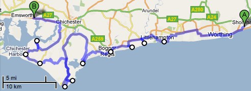
As in the previous parts I haven't mentioned here every little seaside village we passed through and so have produced a list as a seperate blog. This also includes the maps and links to the campsites, note the maps don't always show all the smaller roads.
Day 1 Getting to the Dartford crossing and the Medway
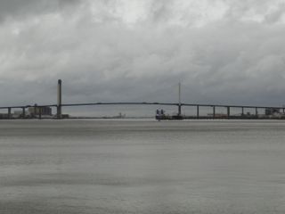
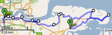
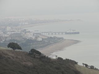
We set off from Salisbury on Good Friday in heavy pouring rain and this rain continued along the M3 and all around the M25 to our restart point. At some places on the motorway there was standing water and we thought 'why are we doing this' but pressed on. As we slowly approached exit 1a of the M25 the rain eased and when shortly after we stopped to take a picture of The Queen Elizabeth II bridge, as if by a miracle, the rain stopped completely. Not only that but the sun put in a fleeting appearance as we passed through Greenhithe on our way to our first real photo opportunity at Gravesend.
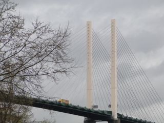

  Our starting point - Greenhithe - Looking up the Thames
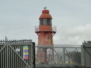  
 
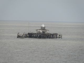
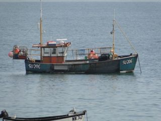
Gravesend: Royal Pier and first 'lighthouse' this trip
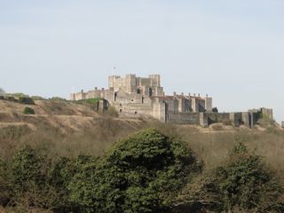
In many ways Dickens is more closely associated with London but he spent many of his formative years in Kent and it is thought that there are references to the neighbourhood of Gravesend in his books. We passed through Chalk, where Dickens honeymooned, and Cooling, both of which gave inspiration for 'Great Expectations' one of my favourites. We also passed near Higham where he died. Then we carried on for a late afternoon walk at the Isle of Grain before booking into our campsite at Hoo. This is old stomping ground for me, I was stationed at The Royal School of Military Engineering Chattenden in the late 60's and met my first wife, Kathy, there.

Cooling Castle - At the Isle of Grain
1st day - 118 miles to the start then 45 coast miles
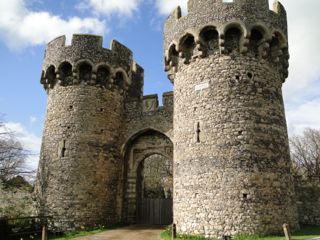
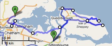
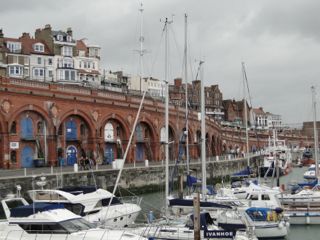
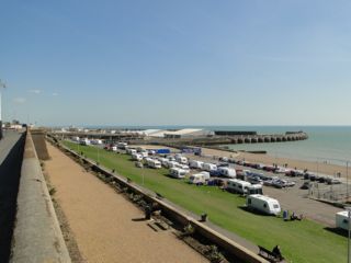
Day 2 Chatham Dockyard and the Isle of Sheppey
There were two competing attractions for Easter Saturday: Dickens World and Chatham's Historic Dockyard. We chose the latter as Dickens World seemed more for children. The dockyard proved to be so good that we decided that we would make good use of our tickets (valid for a year) and return there in September. It is whole-heartedly recommended. We had booked two nights in our first campsite, not intending to do many coast miles, but in the event we left the dockyard in late afternoon and went along to the Isle of Sheppey before returning to Hoo. We now have another serious contender for tackiest seaside place: Leysdown on Sea (other contenders Bridlington, and Chapel St Leonards). Note that any mileage covered whilst not travelling along the coast, as in this case (returning to our campsite and restarting the next day), are always deducted from my overall and daily totals.

Upnor (near campsite)
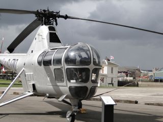
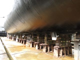
Westland Dragonfly and Underneath HMS Ocelot

2nd day - 52 miles
Day 3 Sittingbourne to Broadstairs
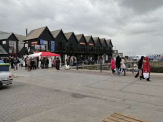
It was a wet start to Easter Sunday, we helped to push others off the campsite and then a damp drive to Sittingbourne but by the time we had got to the coast again at Oare Marsh it had dried up and it was another lovely Kentish day (or should that be day of Kent - an 'insider reference' for those from around here). We had intended going to the Shepherd Neame brewery at Faversham, if it was wet, but (a) it wasn't, and (b) it seemed to be closed. The remainder of the afternoon was spent bimbling along the coast. It included Whistable Harbour where Doreen again declined her first oyster. It stayed sunny all day but the wind got up. Having arrived at Broadstairs we found the Charles Dickens museum for our restart tomorrow.

  
Oare (Harty Ferry) - Whistable: Fresh Fish and Harbour view
 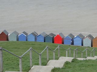
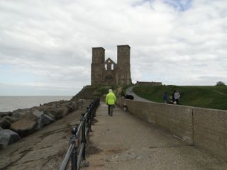 


Huts at Hampton - Pier Head at Herne - Remains at Reculver

3rd day - 54 miles
Day 4 Broadstairs to St Margaret's at Cliffe
The Dickens Museum at Broadstairs celebrates his association with that town, the most well known connection being 'Betsy Trotwood' in David Copperfield who was modelled on a real lady who lived in the house which is now the Museum, it was she who couldn't abide donkeys passing her window and did battle with any boy presuming to take a donkey past her house. I think we enjoyed it more than we would have the theme park in Chatham, but really its only a small collection of sketches, first edition books and letters with some of his furniture and commemorative pottery. It was nice seeing how many, or how few, characters from the books we could recognise. What was good , apart from the cheap entrance fee, was that they sold paperbacks of his major books at just £1.99, you can imagine how some places would ramp up the price of souvenirs. 'Bleak House' was also written in Broadstairs and the house that Dickens used to rent on the seafront is now so-named.
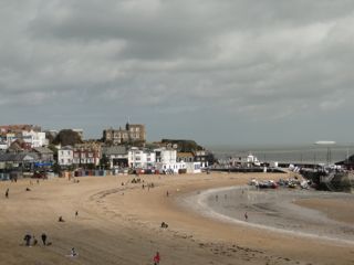

Broadstairs - Ramsgate
There is a toll road from Sandwich to Deal, through the golf course but it is £6 and doesn't save a great deal but it does go closer to the coast so if it had been cheaper we would have paid. As I was performing a three point turn and blocking the single track road a chap in a 4x4 pickup raced up and blasted his horn because I momentarily impeded his passage, he then swore at me saying that I should use my mirrors and that I could have caused an accident. I am trying to think what gave him the particular right to have a go, was it the ownership of golf clubs or the 4x4? Those that know me would be surprised to hear that I was speechless. It wasn't the only example of arrogant behaviour we encountered on this part of the trip on three occasions that I can recall on narrow roads we pulled in for oncoming traffic only to have someone sail past us. (The worst was at roadworks in Bognor where I stopped for a red light only to be overtaken by someone who went through into the face of the traffic that was about to move forward).
As I was due to pass through Dover on my way to Amsterdam about two weeks later we were going to do a 'dry run' by over-nighting on Dover's Marine parade but encountered the other nearby place to wild camp first on the cliff top at St Margaret's at Cliffe, as it was really very suitable we stopped there.


Kingsdown - St Margaret's at Cliffe: Beach and cliff top night stop
4th day - 34 miles
Day 5 St Margaret's at Cliff to Winchelsea Beach
When I look at the 50 or so photos we took on day 5 I realise that today could be best shown by pictures, so, apart from this brief summary I will let the camera tell the story. An early start had us driving past Dover Castle before nine, we had intended to stop at the Battle of Britain memorial near Folkestone but it doesn't open until eleven so we passed that by as well and settled for a walk by the Martello towers at Folkestone. The centre of Folkestone looks quite run down these days but the west of the town seemed rather grand.
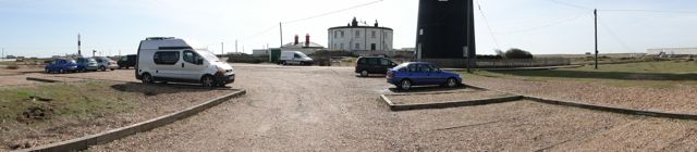
At length we arrived at Dungeness. With its nuclear power stations, lighthouses, shingle beaches and a shanty village of beach houses, some made from old railway trucks its not to everyone's taste but we like it.
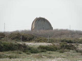
Talking of taste, after a short trip on the Romney, Hythe and Dymchurch railway we sat down to arguably the best fish and chips in the land, at the Pilot Inn (Skate for me, Cod for Doreen). There may be better but if there is we have missed it. Just a little detour then to see the concrete ears at Greatstone (a 1920's early warning system) before travelling on to Rye. I'm not sure about Rye it seems too perfect, it's verging on 'twee'.
Norfolkline arrival Dover Castle
  
- Marine Parade -

Folkestone from the East
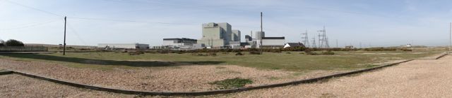
Dungeness requires 3 panoramas to get the picture
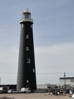


Dungeness also has two lighthouses and a railway
Concrete Ear (see links at end)

 Rye: Just a bit too twee?

5th day - 68 miles
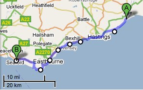
Day 6 Winchelsea Beach to Seaford
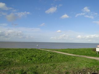
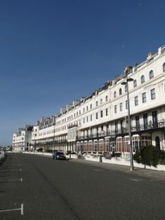
Mostly we have new or fairly new OS Maps of all our coastline but for some reason the map we were to use today is priced at 65p and was probably the first priced in decimal currency. It was a misty dawn and this hung around for most of the day so few photos were taken. We looked in vain for a car park without height barriers on Hastings sea front so we moved on to Bexhill which we liked even if it is a bit drawn out. On our 40 year old map there are rifle ranges at Langney Point but as we left Pevensey Bay we could see the new developments based around the new Sovereign Harbour. The North or East side of which was very posh (the West side has an ASDA) Well we liked some of what we saw but it having found the gated centre it looks like another rich man's ghetto. If I could afford to live in such a place the fact that I had to keep inside a gate for fear of what might otherwise happen would prey on me. It was quite a relief (after refuelling at ASDA) to get into the more open grandeur of the more traditional Eastbourne
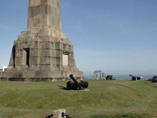
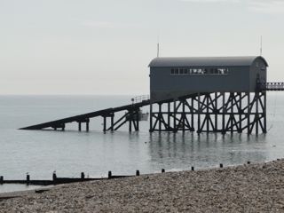
The highlight of the day was Beachy Head, unfortunately the mist hadn't cleared but full marks to the good people of Eastbourne for stumping up the money to keep Beachy Head in public hands even if it was for the slightly less than altruistic reason of preserving their view to the South West. Sad to see all the little bunches of flowers at the cliff edge, led me to wonder if many go off the edge by accident rather than by design. Certainly only the areas near crumbling edges are fenced. A coach load of French school children were near one part of the cliff top herded by several rather anxious looking teachers.
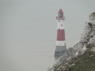
   
  
Misty Eastbourne - Beachy head Lighthouse - The Cliffs
6th day - 48 miles
Day 7 Seaford to Lancing
After leaving our Seaford relations at midday we drove along the sea front, then a half or mile or so further on went down a little track (past a height barred car park) to a layby just before a gated railway crossing and so got to Tide Mills. Originally a village, with a mill and later a hospital stood on the shingle here. The Mill became disused about the time the hospital was set up (around 1900), villagers hung on even though there was no sanitation until the last few were forcibly removed at the start of WWII. Because of the fear of German invaders all the buildings were demolished then to avoid giving cover. The hospital was for the rehabilitation of disabled boys who had undergone surgery, the charity running it was called "Guild of the Poor Brave Things". The dogs especially liked it because at the far end near the entrance to Newhaven harbour there was a little bit of sand amongst the shingle and the water was calm enough for a swim.

 
Seaford - Beach at Tide Mills
Height barriers at Newhaven stopped us getting to the harbour mouth but from there on it was plain sailing as the main road through Brighton to Shoreham more or less hugs the beach. At Brighton we parked for a late lunch overlooking the marina and a fairly large contingent of travellers encamped by the road beneath. Looked tidy enough but I noticed that they were restricting the passage of traffic through the road by a mobile barrier of three white vans. Surely not the reason for a hundred miles of height barriers though.
Brighton - encampment

7th day - 49 miles
Day 8 Lancing to Chidham
Leaving our campsite quite early quickly brought us to Worthing and once we had passed the town centre we stopped for some gentle exercise. A walk for us and the dogs followed by ball throwing for one dog and a cup of coffee for us and cuddles for the other dog. We thought Worthing very fine but the rest of the places as we travelled westward on this sunny morning made us grumpy until we got to Selsea Bill.

  
West Worthing
After Worthing we lost count of the height barriers (They were erecting brand new ones at Climping Beach) and other restrictions to Motorhomes (we fit on to an ordinary parking space) and they have the following effect on me: I just drive on through and don't refuel or shop or spend money. It also makes us less likely to seek out those hard to find little gems. Arun District seem not to like us and as for the no go areas (large private estates of Aldwich, Angmering-on-Sea etc) well you just end up with a sort of ghetto so they are welcome to it. Pagham was difficult having got to Sea Lane perhaps we misread the signage because we turned back before finding the car park at the end of Harbour Road and so perhaps prematurely started the huge detour around Pagham harbour to Selsey Bill. We did find solace in Selsea Bill after visiting some narrow roads near Church Norton, It had been a very frustrating morning. I side with the regal advice of George V who apparently said 'Bugger Bognor' on his death bed.

 
At Selsey Bill
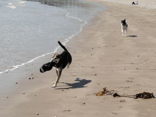
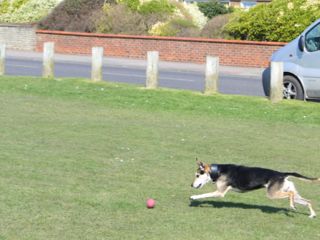
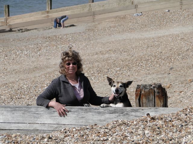
It has been pointed out by the management that pictures of Jake seem to be few and far between. Well he's the sort of dog that is always 20 yards behind the action. Anyway he spent this particular walk off the shingle and preferred the wall as the path had the occasional pebble to be skirted around. Problem was that every ten yards there was a bench set on the wall which he had to negotiate
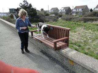

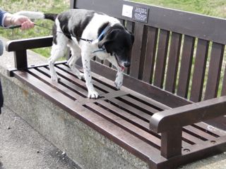  
 
Jake's Coast - Selsea Sea Wall
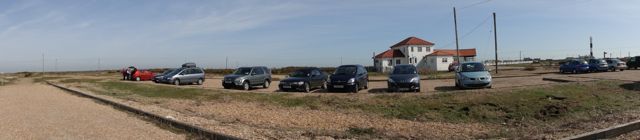
Our final stop for the day was the sea parking at West Wittering. It cost us £2 as we arrived after 3pm. That's another pet hate of ours by the way, car parks that just have a daily rate when we want to stop for an hour or so. I remember a car park in South Wales that wanted to charge us £7, I think, half an hour before the gates were closing. Anyway west Wittering does have a reduced rate after 3pm so that was fine. Goodness knows how much income they get on a daily basis, there is room for thousands of cars. It was our first wide expanse of sand, as opposed to shingle or mud, since Broadstairs.

8th day - 76 miles
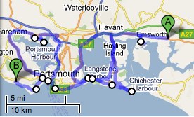
Day 9 Chidham to Browndown
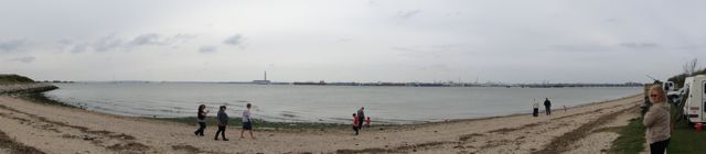
Just ask these two if they are enjoying it (Hayling Island)
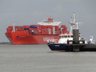
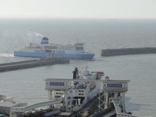
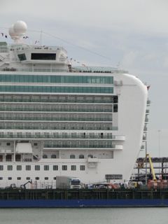
We spent most of the morning at Hayling Island before going on to Southsea and Portsmouth and starting our last OS map. As a place to sit and watch the world go by Old Portsmouth at the mouth of the harbour (Spice Island) is difficult to beat. There are the green and white Gosport ferries, The Wightlink Ferries to Fishbourne IOW and their high speed ones to Ryde pier. Larger cross channel ferries including mammoth high speed ones (as pictured) pass every hour or so and there is a constant trickle of sailing and power boats. If you look round the corner you will catch sight and sound of the hovercraft to Ryde from just outside the harbour. Beer is laid on by the Spice Island Inn and there are plenty of people watching opportunities too. PS sorry about the first photo, I have only just noticed the waste bin and rusty railings, I was looking after two dogs and a beer at the time.
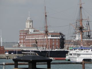
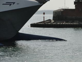
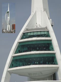   
  
Portsmouth Images: Ancient and Modern - Prow of high Speed Ferry - Spinnaker tower visitors
Having reached Portchester by around tea time we had a dilemma. We could push on and finish that night, probably only about 40 or so miles to go, but the weather was still nice and some relations of ours would be in Southampton on the morrow so we booked ahead into a campsite near Stokes Bay, Gosport. Well that was nearly an expensive mistake the untidy campsite cost us £18, the indifferent meal in Alverstoke £30, drinks and a light meal with our relations on the Sunday another £40 . Nearly expensive? I left our £450 camera at the restaurant on Saturday night but luckily there was someone there on Sunday morning and it had been found. This blog would also have been shorter with no photographs.
9th day - 64 miles
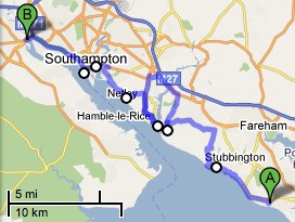
Day 10 Browndown to THE FINISH
After recovering our camera we continued westward passing by the lovely spot that is Hill Head and through the narrow 6'6" restriction (we just qualify) to Warsash and the River Hamble then around the river to Hamble le Rice, I never knew it was called that always called it just 'Hamble' when I used to sail from here twenty years ago. We found a new wild spot nearby currently occupied by a pleasant new age traveller with the obligatory "Atomkraft? Nein Danke" and a wood burning stove in her old Renault Master.

Panorama at Hamble Point
From there we were soon over the Itchin bridge and on to our finish point at the end of Southampton Water but first a stop to see Azura the new P&O cruise liner which was making its inaugural visit and had just been named by Darcey Bussell (what no Royals!) It looked really big apparently the biggest ever made solely for the British fleet and cost a mere £300,000,000 and quite dwarfed Oriana who was upstream at her normal berth.


Seen in Southampton
Then to our finish point 50° 55' 12" N 1° 28' 42" W which we reached at 13.49. The total mileage was 6,512 and that doesn't include of 3,132 miles of out and back trips to the start and finish points of each section. We hoped to be able to spend some time at or nearby our finish point as, on the opposite carriageway on the Redbridge flyover, is a small car park. Well on Easter Sunday 2007 when we started this odyssey they were working on the flyover and it caused us a diversion and three years and three days later they had closed the car park to store construction equipment whilst working on the Redbridge flyover some more, Hey ho. Plus ça change, plus c’est la même chose.
Well all that remains is to write a summary and choose our favourite places, days etc which I will do later.
10th day - 33 coast miles
Link to Concrete Ears www.culture24.org.uk/science%20%26%20nature/technology/art17649
Link to The whole trip summary Coast 'Summary'